A Tiny Tool for Travel Maps
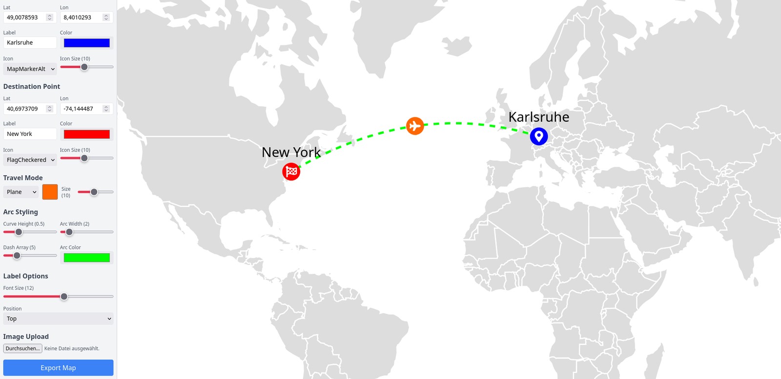
In 2024 I needed maps of the trips in a photo book. Google Maps screenshots are ugly. Mapbox via API is overkill for a handful of maps. Drawing them in Inkscape takes a whole afternoon of fiddling.
So I built dynamic-travel-path-visualizer. You set an origin and a destination, get an arc between them on a world map and export the result as SVG. No backend, no API key.
What it does
- Origin and destination by coordinates, or taken from the GPS data of a photo.
- Travel modes: flight, car, train.
- SVG export of the world map and the route as vector paths, scalable to any print resolution. The file name comes from origin, destination and travel mode, for example
Home-London-by-Plane.svg. - Optional animation of the path and markers with CSS keyframes.
- Customisable styling: curve height, line width, dash style, markers.
The export is plain SVG without exotic features. It opens in Illustrator or Inkscape if you want to keep editing.
Tech
React with react-simple-maps for the world map and d3-shape for the arcs. npm run build produces static files for any web server.
I am posting it in case someone else is looking for the same kind of tool.